Reading view

There are new articles available, click to refresh the page.

National Weather Service seeks winter weather spotters in Detroit

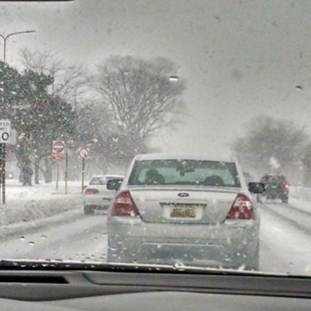
The National Weather Service expects a warmer and wetter than normal winter in southeast Michigan. But that doesn’t rule out chances for a few days of heavy snow, ice, and bitter cold.

The Detroit/Pontiac forecast office is looking for volunteer winter weather spotters to report extreme conditions.

What do spotters do?

Gov. Gretchen Whitmer has declared Nov. 3-9 as Winter Hazards Awareness Week in Michigan. NWS Meteorologist Steve Considine says the agency will train people how to identify winter some of the most significant ones.

“That can be terrible road conditions, tree damage, or power lines from either high winds, heavy snow, or ice,” he said. “They report snowfall and rainfall amounts directly to the National Weather Service.”

Read more: Observers track rain data on Detroit’s flood-prone east side

Considine says spotters play a critical role in reporting and understanding the effects of severe weather.

“It gives us kind of a big picture as to what is going on during adverse weather conditions in communities,” he said. “It gives us a little bit of ground truth from what the radar and observational data are indicating.”

The training sessions are free, but spotters will need some basic equipment.

“For rainfall, they will have to have a rain gauge,” Considine said. “For snowfall, it’s just a ruler and a plain piece of wood set outside.”

Where to sign up

The weather service will hold in-person training sessions in Detroit on Nov. 13 and 16.

Considine says the agency wants to gather more weather information from city residents so meteorologists can understand how weather affects them.

Trusted, accurate, up-to-date.

WDET strives to make our journalism accessible to everyone. As a public media institution, we maintain our journalistic integrity through independent support from readers like you. If you value WDET as your source of news, music and conversation, please make a gift today.

Donate today »

The post National Weather Service seeks winter weather spotters in Detroit appeared first on WDET 101.9 FM.
Detroit’s winter outlook trends warmer and wetter

The National Weather Service says this winter could be warmer and wetter than usual in southeast Michigan.

The agency recently issued its seasonal outlook for the region. It forecasts the chances of various weather scenarios based on 30-year averages.

The probabilities favor higher-than-normal temperatures and precipitation between Dec. 1, 2024, and Feb. 28, 2025.

Meteorologist Trent Frey says a phenomenon known as La Nina will affect our weather patterns.

“La Nina is when the Pacific Ocean waters near the equator are cooler than the long-term average,” Frey said. “It affects where the jet stream sets up during the winter months, and that affects how it steers storm systems across North America.”

Winter is coming…right?

The past two winters in southeast Michigan were among the 10 warmest since the U.S. government started keeping records for Detroit in 1874. Frey says 2023-24 was the warmest winter on record for the Lower Peninsula of Michigan. He says warmer winters are becoming more common.

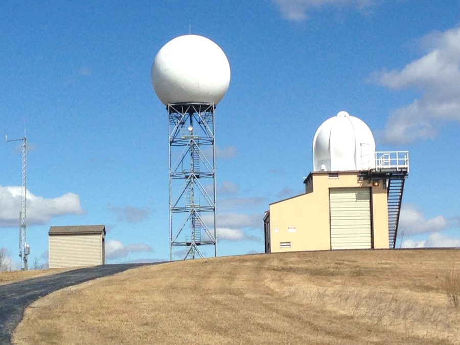
The National Weather Service’s Detroit forecast office is in White Lake Township.

“The way that climate change is manifesting here in southeast Michigan is that our winter months are becoming warmer much faster than our summer months are,” Frey said.

Read more: Sour weather bites Michigan’s sweet cherry growers

Detroit’s average high temperature in winter is 35 degrees Fahrenheit. Frey says over the past 15 winters, the normal temperature has risen by about one degree compared with the longer 30-year average.

“That might not seem like much, but is pretty significant,” Frey said.

Slushy, anyone?

Southeast Michigan typically gets about 6.5 inches of rain and almost 3 feet of snow a year.

Frey says it’s hard to predict how much snow will fall this winter.

“Out of the past five week La Ninas, we’ve seen two of those had above normal snowfall, two of them had below normal snowfall, and one of them had near normal snowfall.” Frey said.

Last winter’s outlook accurately predicted warmer temperatures, but slightly underestimated rainfall.

“It actually ended up being a little wetter than normal,” Frey said. “But because we were so warm, our snowfall ended up being about 20 inches below the normal.”

The NWS Detroit forecast office recorded almost 2 feet of snow in 2023-24. That’s the 16th smallest amount of annual snowfall on record for the region.

The agency is recruiting volunteers to be winter weather spotters.

Trusted, accurate, up-to-date.

WDET strives to make our journalism accessible to everyone. As a public media institution, we maintain our journalistic integrity through independent support from readers like you. If you value WDET as your source of news, music and conversation, please make a gift today.

Donate today »

The post Detroit’s winter outlook trends warmer and wetter appeared first on WDET 101.9 FM.

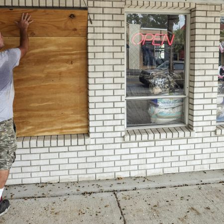
What to know about Hurricane Milton as it moves toward Florida’s Gulf Coast

Not even two weeks after Hurricane Helene swamped the Florida coastline, Milton strengthened into a major hurricane that is headed toward the state.

The system is threatening the densely populated Tampa metro area — which has a population of more than 3.3 million people — and is menacing the same stretch of coastline that was battered by Helene.

Traffic was thick on Interstate 75 heading north on Tuesday as evacuees fled in advance of Milton. Crews were also hurrying to clear debris left by Helene.

When will Milton make landfall?

According to the National Hurricane Center’s Live Hurricane Tracker, Milton will make landfall on Florida’s west coast late Wednesday. It’s expected to be a Category 3 storm, which have winds of 111-129 mph (180-210 kph), when it comes ashore in the Tampa Bay region, which has not endured a head-on hit by a major hurricane in more than a century.

It could retain hurricane strength as it churns across central Florida toward the Atlantic Ocean. That path would largely spare other states that were ravaged by Helene, which killed at least 230 people as it moved from Florida to the Carolinas.

How strong will it be?

Milton intensified quickly over the eastern Gulf of Mexico. Florida Gov. Ron DeSantis told reporters Tuesday morning that “We must be prepared for a major, major impact to the west coast of Florida.”

Milton was a Category 5 hurricane with maximum sustained winds of 180 mph (285 kph) and was centered about 675 miles (1,085 kilometers) southwest of Tampa late Monday afternoon.

Those winds eased to 145 mph (233 kph) by Tuesday morning and the hurricane was downgraded to Category 4 status. It was centered about 545 miles (877 kilometers) southwest of Tampa. The hurricane center said Milton will remain “an extremely dangerous hurricane through landfall in Florida.”

How bad is damage expected to be?

Florida’s entire Gulf Coast is especially vulnerable to storm surge.

Helene came ashore about 150 miles (240 kilometers) away from Tampa in the Florida Panhandle and still managed to cause drowning deaths in the Tampa area due to surges of around 5 to 8 feet (1.5 to 2.5 meters) above normal tide levels.

Forecasters warned of a possible 10- to 15-foot (3- to 4.5-meter) storm surge in Tampa Bay. That’s the highest ever predicted for that location.

The storm could also bring widespread flooding. Five inches to a foot (13 to 30 centimeters) of rain was forecast for the Florida Peninsula, with as much as 18 inches (45 centimeters) expected in some places.

What if I have travel plans to that part of Florida?

Tampa International Airport said it halted flights at 9 a.m. Tuesday. The airport posted on X that it is not a shelter for people or their cars.

St. Pete-Clearwater International Airport said it is in a mandatory evacuation zone and will close after the last flight leaves Tuesday.

How is Mexico preparing?

Mexican officials were organizing buses to evacuate people from the low-lying coastal city of Progreso on the Yucatan Peninsula after Mexico’s National Meteorological Service said Hurricane Milton “may hit between Celestun and Progreso.”

Celestun, on the western corner of the peninsula, is a low-lying nature reserve home to tens of thousands of flamingos. Progreso, to the east, is a shipping and cruise ship port with a population of about 40,000.

The post What to know about Hurricane Milton as it moves toward Florida’s Gulf Coast appeared first on WDET 101.9 FM.
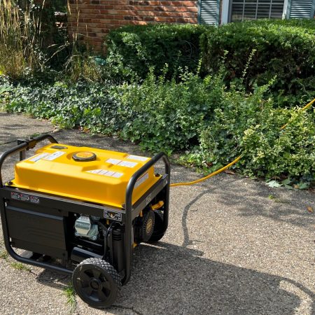
Detroit Evening Report: Power outages continue; Detroit Jazz Festival and more

On this episode of the Detroit Evening Report, we cover the continued power outages across metro Detroit following this week’s severe storms; the upcoming Detroit Jazz Festival and more.

Subscribe to the Detroit Evening Report on Apple Podcasts, Spotify, NPR.org or wherever you get your podcasts.

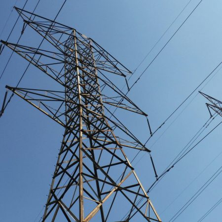
Thousands still without power after storms

More than 60,000 metro Detroit residents are still without power on Thursday after severe storms hit the region Tuesday evening and continued into Wednesday. DTE Energy says crews are “continuing to work as quickly and safely as possible to restore power to everyone impacted by the extreme weather.”

The company says it has restored power to more than 80% of its customers and expects to have 90% of customers restored by end of day Thursday, with remaining customers expected to be restored Friday.

Detroit market offers up fridge space during outages

Neighborhood Grocery in Detroit’s Jefferson Chalmers neighborhood is offering refrigerator space to those who are still without power. The market posted on Facebook Wednesday offering up fridge space for medications or freezer space for perishables for those in need of temporary storage until power is restored. 

Corktown ranked top ‘up-and-coming’ neighborhood in US

Detroit’s historical Corktown neighborhood has been ranked a top “up-and-coming” neighborhood in the nation by Travel Mag. The magazine cited spots like Mercury Burger and Bar, Bobcat Bonnie’s and Brooklyn Street Local as hot spots to grab a bite, and also mentioned the reopening of Michigan Central as part of the neighborhood’s resurgence. The neighborhood was listed among 16 others in cities like Chicago, Los Angeles, New York and Miami. 

Freedom Arts Festival continues

Programming for the Detroit Parks Coalition’s annual Freedom Arts Festival will continue throughout the fall season. The free festival series kicked off in June and will run through November with a variety of events hosted across nine parks and public spaces in the city.  Supported by the Knight Foundation and the Community Foundation for Southeast Michigan, the festival features live performances of music, dance, storytelling and art reflecting Detroit’s rich multicultural history, weaving together narratives of freedom, racial justice, connections to place and more. For more information on future programming, visit detroitparkscoalition.com/freedom-arts-festival.

Detroit Jazz Festival returns

The Detroit Jazz Festival kicks off at 6:40 p.m. on Friday, Aug. 30 in Hart Plaza. with performances continuing in downtown Detroit through Labor Day weekend. Over 60 performances are scheduled to take place throughout the long weekend, including from The Bad Plus, Carmen Lundy, artist-in-residence Brian Blade and the Fellowship Band and more. The festival will have stages in Hart Plaza, Cadillac Square and after hour specials in Midtown at Wayne State’s Valade Jazz Center. For more information, visit detroitjazzfest.org.

Do you have a community story we should tell? Let us know in an email at detroiteveningreport@wdet.org.

Trusted, accurate, up-to-date.

WDET strives to make our journalism accessible to everyone. As a public media institution, we maintain our journalistic integrity through independent support from readers like you. If you value WDET as your source of news, music and conversation, please make a gift today.

Donate today »

The post Detroit Evening Report: Power outages continue; Detroit Jazz Festival and more appeared first on WDET 101.9 FM.

Detroit Evening Report: Severe storms cause damage, power outages throughout Detroit area

Some Detroiters are without power and others still cleaning up after severe thunderstorms hit the region both on Tuesday and Wednesday night. 

Subscribe to the Detroit Evening Report on Apple Podcasts, Spotify, NPR.org or wherever you get your podcasts.

The National Weather Service reported wind gusts of more than 75 miles per hour at Detroit Metro Airport Wednesday night, with high winds bringing down tree branches and causing power outages around the region. 

DTE Energy reported more than 200,000 power outages Wednesday morning. Weather on Thursday is expected to be mostly dry and humid, with a high of 81 degrees. Thunderstorms are likely to return on Friday with heat indices ranging
from the upper 80s to mid 90s.

Other headlines for Wednesday, Aug. 28, 2024:

  • Outages on the Dearborn-Allen Park border caused problems for motorists trying to get to Detroit Metro Airport Wednesday morning.
  • Detroit has set up cooling centers to keep residents safe during the high temperatures that blanketed Detroit this week.
  • Former Detroit City Council President Saunteel Jenkins is considering a run for Detroit mayor.
  • Wayne State University is holding a special grand opening reception on Thursday for its newest music venue, the Gretchen C. Valade Jazz Center.
  • The Detroit Lions have made a number of roster changes to get ready for the NFL regular season.

Do you have a community story we should tell? Let us know in an email at detroiteveningreport@wdet.org.

Trusted, accurate, up-to-date.

WDET strives to make our journalism accessible to everyone. As a public media institution, we maintain our journalistic integrity through independent support from readers like you. If you value WDET as your source of news, music and conversation, please make a gift today.

Donate today »

The post Detroit Evening Report: Severe storms cause damage, power outages throughout Detroit area appeared first on WDET 101.9 FM.

❌